WEDNESDAY, July 24th
This was the day we traveled the Snaefellsnes Peninsula (the middle of three peninsulas that extends off the west coast of Iceland) with Olafsvik being our final destination (about a 2 1/2 hour drive). We made periodic stops as we learned more about Icelandic history (like the country's best known serial killer, Axlar Bjorn, from over four centuries ago) and took in the amazing scenery and rock formations on land and at sea.
A beautiful morning leaving Reykjavik.
On the other side...
We made a pit stop in Borgarnes.
Dad picked up some kleinur which are Icelandic treats that are a cross between a doughnut and a scone.
More of the drive.
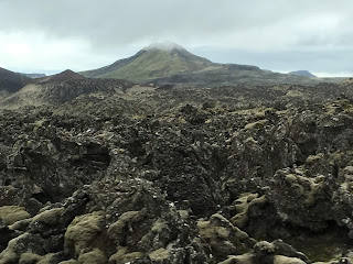
There were plenty of other craters as well. The lava rock terrain in this picture makes it look like you're on the moon.
And another one.
And another one.
This was the area where we learned about the country's, not just best-known, but only known serial killer. His story was something right out of a Criminal Minds episode, having killed up to 18 people and throwing their bodies in the nearby lava fields. He was executed in 1596.
This looks like a white church with a red roof, but it's actually a house. And a very popular one. The clouds are blocking the full scene, but the Snaefellsjokull glacier volcano is behind it and quite a view with the coastal waters.And yowzers! Was it COLD!!! This was the first time we were really feeling the icy temperatures, thanks, mostly to the wind coming off the water. I was just grateful it wasn't raining. The coastline is breathtaking!
We jumped back in the car to thaw out and headed just down the road and met this guy.
"Although this looks like a decorative pile of rocks, the Bardur Snaefellsas statue commemorates the story of a medieval Arnarstapi resident. Bardur was a half-man, half-troll who lived here after fleeing Norway. After a severe family argument, he exiled himself to the Snaefellsnes Glacier. For centuries, the locals believed he was their protector and called him the Guardian Spirit of Snaefell."
These were our coastal views as we continued up the path from Bardur.
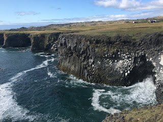
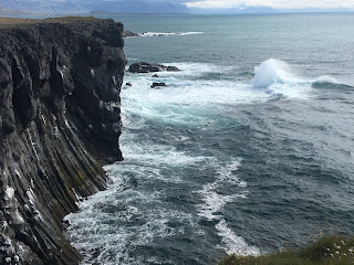
I love these next two shots. You can see some of the basalt formations on the bottom right where the rock has been worn away and water is pooling in white foam. The next picture shows the waves crashing there.
Watching the waves come in.
White church with a red roof down by the sea #3.
Further down the road we came to the small village of Hellnar. "Hellnar is an old fishing village on the westernmost part of the Snaefellsnes peninsula. It used to be one of the largest fishing stations of the peninsula, with the oldest written record of seafaring there from 1560."
Close by is Londrangar or "rocky castle"--what looks, from a distance, like a sea castle. In reality, "Lóndrangar are uniquely formed basalt volcanic dykes sticking out from the ocean and are the remains of a crater, which has been eroded to its present form by the sea. Lóndrangar consists of two pillars or stacks, one of 246 feet and the other one of 200 feet." Pretty spectacular!
Snaefellsjokull with cloud cover. Still quite a sight.

I swear that every vehicle in this country is either white or light gray!
We stopped at Djupalonssandur and Dritvik National Park--the Black Lava Pearl Beach on Snaefellsnes. We enjoyed a pleasant break (out of the wind) while eating our lunch at the Djupulon lagoon.
This lagoon was said to be abysmal as it was so deep. But the lagoon was measured back in the 1700s and turned out to not be abysmal but only 5 meters (or 16.5 feet).
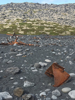
On the beach are the iron remains of the British trawler Epine GY7. It wrecked east of this beach in March 1948 during a blizzard. Fourteen of the crew died, but five were saved. Most of the bodies were never recovered. The iron remains, which washed up on the shore, are protected and should not be touched or removed as a monument to those brave fishermen from England.
Mom sat down on the black lava pearl beach as waves crashed on the shore.
The view behind Mom.
The view to the left of Mom.
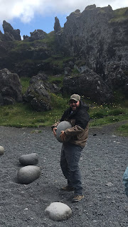
These are Aflraunasteinar-Steinatok or lifting stones. The Icelandic sailors who rowed out to fish from open boats tested their strength by lifting these stones. Jared gave it a whirl. They are not very easy to hold on to! Haha!
There is a peculiar rock with a hold in it called Gatklettur. Through the hole you can see Snaefellsjokull glacier.
I don't watch Game of Thrones, but I'm told that this specific spot (the hole in the rock) was filmed in the series.
We tried sitting down for a picture, but every spot was pointy and Jared had something to say about it. Which made me bust up laughing.
These next few pictures are from the path through the lava field with huge lava formations that leads you from the parking lot to the beach. It's a bit magical. The name of the path is Nautastigur--the Path of the Bulls--derived from a bull being led down this path and watered at the lagoon.

This was the most we saw of Snaesfelljokull that day.
This is the Saxholl crater. You could climb it, but we opted instead to admire it from the car.
It's fascinating to see the landscape change from rolling grass hills to lava rock.
And here is the tallest structure in the entire country: the Hellissandur longwave radio mast that is 1351 feet high.
It's hard to believe this tower is 5.5 times taller than the Lutheran church, Hallgrimskirkja, in Reykjavik. Even though "tower" and "mast" are used interchangeably, this is more accurately a mast because it's held in place by stays or guys whereas towers are self-supporting. Built in 1963, it's one of the tallest structures in western Europe.
Cute little thatch-roofed houses.
On the northern side of the peninsula, we approached Svodufoss, a cool waterfall from the River Laxa.
Dad, Jared and I got out and walked to the viewing platform while Mom rested in the car. There wasn't a path up to the falls, but it looked like a fairly easy trek to the top. So the three of us decided to give it a whirl.
Making our way up.
Daddy-daughter picture.
There wasn't anyone else out there, so we decided to follow the falls on the left side to see if it was possible to make it to the top. This was the halfway point.
Dad decided to wait for us at the halfway point. This is looking back out toward the sea.
And we kept trucking to the top. Svodufoss is about 10 meters (32 feet) high and is gaining more attention.
We made it!
There wasn't a soul (human or animal) anywhere in sight. Even though we saw a few cars in the parking lot. But it turns out there was a French couple who was already there. We recognized them as the pair on a motorcycle who were heading the same direction as us on the highway. They asked if we'd take their picture and then they'd take ours. We agreed, but man, they were sitting on the edge, dangling their feet and it made me a little nervous.It's powerful and beautiful and so serene. And there was plenty of flat land at the top where one could build a little cottage. Just sayin!
I'm so glad we went on this little unplanned adventure.
On our way back down, I took these pictures.The ocean view.
The pool at the bottom.
Dad taking a little snooze while waiting for me and Jared. :)
On our way to the little hotel room we'd be staying at, we stopped at the store. I liked the retro Betty Crocker look on these boxes of cake mix.
We were making fun of Jared for his two sodas and two packages of cookies. I just happened to catch this classic, though rarely photographed, crusty face expression.
Haha!
Olafsvik is a small town on the northern side of Snaefellsness Peninsula. Mom and Dad have stayed at Welcome Apartments a couple times. There were four twin beds (that we pushed together to make two queens),
a small round table with chairs and small TV,
a teeny tiny, but very functional kitchenette with a two burner stove, mini fridge, microwave and sink,a bathroom sink and shower,
and the toilet. :)
The view from our second story window.
We played Five Crowns that night and these were two different hands that two of us had. Pretty wild!THURSDAY, JULY 25TH
The breakfast of champions, even in Iceland, in a very flat bowl. :)
The photography in our hotel room. This was our first destination spot for the day--Kirkjufell meaning "Church Mountain" with the small, but popular Kirkjufellsfoss waterfall across the road.Another white church with a red roof--#4! :)
It was definitely more cloudy and overcast, but it wasn't about to dampen my spirits! It was about a 23 minute drive from Olafsvik along the northern coast to Kirkjufell.
Kirkjufellsnes waterfall.
Kirkjufell Mountain.
The pool at the bottom of the falls.
The falls from different perspectives.From the viewing platform
Kirkjufell is 1,519 feet high and claimed to be one of the most photographed mountains in the country. Scenes from Game of Thrones have also been filmed here.
Continuing around the northern shore of the peninsula via Route 54, we drove through the town of Grundarfjordour.
And saw Grundarfoss waterfall from a distance.
It's fascinating to me how the landscape can be so diverse in such a short amount of time.
Now it looks like something you'd see on the surface of the moon or Mars.
These are crazy jagged lava fields.And back to green grass again.
We arrived at the town of Stykkisholmer which is located on the northermost part of the peninsula. It is surrounded by innumerable islands and was featured in the movie "The Secret Life of Walter Mitty." This is the harbor.
The island of Sugandisey is tall with sheer cliffs created by basalt columns. It protects the Stykkisholmur harbor from weather and waves and is Stykkisholmur's most distinctive landmarks.
View of Sugandisey. The island was connected to the land in 1989 and also functions as a road to the ferry.
We hiked to the top of Sugandisey.
My favorite part--the small but mighty lighthouse!Jared and I got our picture taken on a basalt column outcropping, overlooking the inlet.
The lighthouse view from a lower path.
Jared and Mom.
A whale-watching tour coming back in to the harbor.
You can really see the sheer sides of Sugandisey here.
We found the gift shop nearby, used the facilities and checked out the souvenirs for our kids. We found a plate and cup set for JJ with kid vikings on it, a bracelet made out of black lava rocks and other volcanic stones for Karcyn, as well as a stuffed puffin. I was super giddy, though, when I found some local yarn from Skarpa. Skarpa yarn is made from the wool of the sheep from Grishol in Helgafellssveit and Stadur in Reykholasveit. It has traceability to each sheep. Attached to the label is a picture of the sheep that the yarn is from and some information about her. All the colors were natural. Thinking of Cooper and how much he loves to crochet, I thought it would be pretty awesome for him to make something out of Icelandic wool that came from the one and only sheep named Astrid (his favorite character from the "How to Train Your Dragon" movies). I grabbed two bundles for him and I have to say, I was most excited about his gift than any other.
We drove out of town and happened to discover a very well hidden picnic table in an unusual cluster of trees in which to eat our sack lunch.
But be warned, no pooping allowed!!
Lunch selfie!
We began our trek back to Reykjavik.
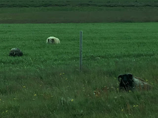
They grow a lot of hay in Iceland. Sheep wander all over the countryside and mountains. Some have horns. The horses have their own special gait, and are super friendly. Horses haven't been imported into the country since 892 in order to keep the breed pure. They will, however, ship horses out.
We hoped to make one more last stop before getting back into town. It was a little tricky because it's unmarked, but we finally found Ytri Tunga, an unusual beach of golden sand, rather than black. But the best part of this gem is that it's one of the top three most reliable places in Iceland to see seals! In case anyone is interested, the turn off is 18 km west of the 54/56 junction. There are a cluster of brown houses with red doors/roofs and the road looks like a driveway. This is what you're looking for from the road.
In order to see the seals, we had to negotiate an entire shore and plethora of huge boulders as we strategically jumped on and over them at the beach. It was actually really fun!
The seals are soooo cute! It was so quiet out by the seals as we all stood in awe, not wanting to frighten this little guy. But didn't seem to be bothered by humans.
Jared making sure to represent Aggies in Iceland.Such a sweet face.
Dad's idea of a funny picture. :)
These were the seals on the opposite side that Mom and Jared had been watching. There are several lined up on the ground on the middle right of the picture and a white-ish one on the big rock in middle of the picture, facing us.
It looked as though the seal would fall right off the rock. It certainly did not look comfortable!
A message in the sand. I didn't write it, but it applies!!
Off in the distance, a seal makes the iconic "banana" pose where it stretches its head and tail up simultaneously.The view looking away from the beach.
Some local waterfowl.
Huh. Apparently there is a sign posted that tells about the seals and to not get too close. Whoops. Now I know!Jared relieved my dad and got to drive in Iceland!
A big and fluffy, predator-free sheep.
Icelandic horses.
We stopped at a store on our way home for gas. I thought this was quite the display of yarn in the most unexpected of places. We also found some awesome grocery carts that go front, back and *sideways*! We got a video of Jared demonstrating with the cart. So cool!
To the tunnel.
Reykjavik again.
Overlooking Reykjavik at 8:33pm.
Sunset: 10:43pm.

















No comments:
Post a Comment